Every part of the week in Canada is magical, but let us talk about a little magic found in the map of Red Lake. There is a beautiful map hanging in the main lodge. I have one stowed away in my tackle box and one on my wall at home. If this summer brings your first trip to Eagle Falls Lodge, your waterproof copy is awaiting purchase. This map is good for finding fish, planning adventures, and recounting the day’s successes.
I like starting out the day in front of the map in the main lodge with my fishing partner. If there is a wind blowing across Parker Lake behind us we can use the map to locate all of the shores awash by wind-swept waves – the shores with mud-lines. These mud-lines attract walleye with the promise of food washed in from the banks. After a successful morning catching the most edible sized walleye (16-17″) we meet at the predetermined (using the map) location for our shoreline lunch.
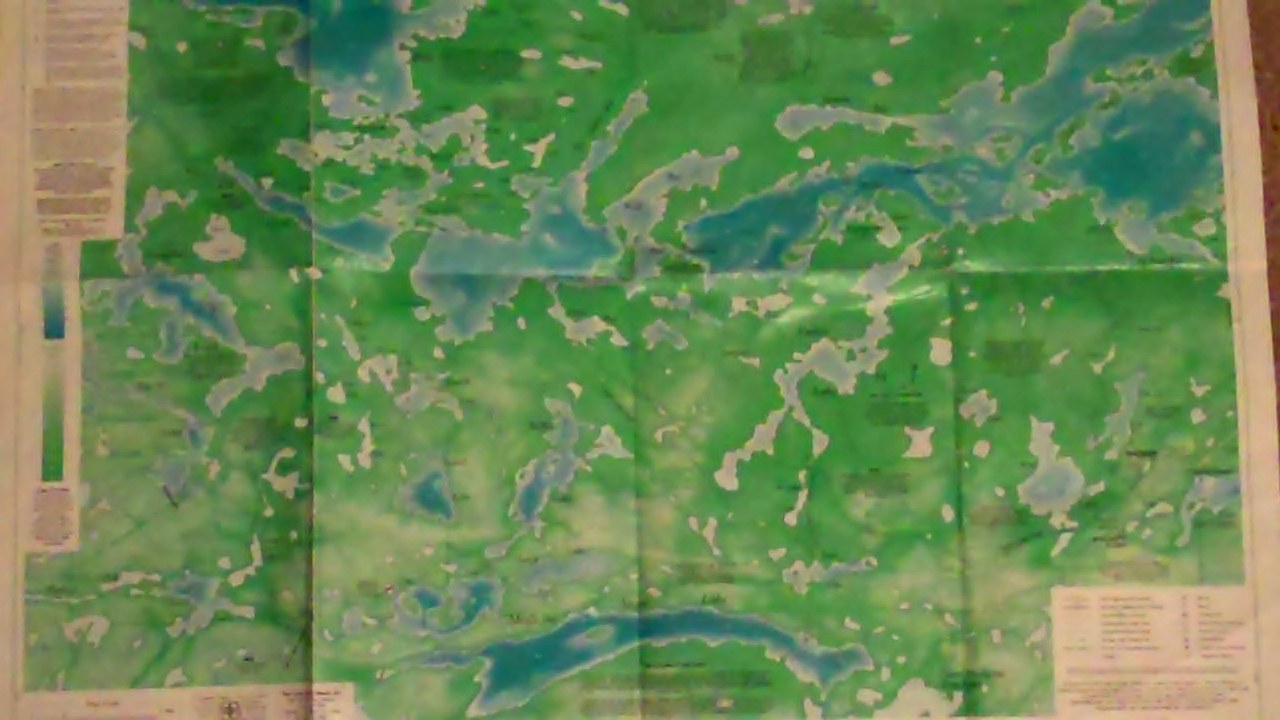
Following the finest fish dinner I have found anywhere, sometimes I feel like adventure. This might be found in casting or trolling for the aggressive and hard-fighting northern pike which are frequently found in the pools below flowing water. I reference the map to find rivers and creeks feeding into Red Lake and Parker. Sometimes I feel like finding a new walleye fishing spot. Walleye depth is usually figured out during the morning fishing trip. Using this knowledge and my trusty map I can fish at similar depths, which are frequently very productive. If I feel like a sight-seeing adventure, the Red Lake map also highlights historical landmarks which include wagon roads, abandoned gold mines and pictograph island which depicts the ‘Legend of Red Lake’.
At the end of the day I have used the map several times. It helps me catch fish, meet for lunch, locate new fishing locations and explore. Through all of this I don’t get lost and I don’t hit rocks with my new 20 hp motor because I have navigated with the map as well. I have one last use for the map before the day ends. Near the wood stove in the main lodge (see right side of the picture below, courtesy of Carson Mack) the map on the wall collects the tales of the day’s feats. It is the perfect visual aid for showing where the walleye were brought up as fast as I could get my line back in the water, where the I caught and released the 42″ northern pike as the wind washed the boat farther up the creek that was emptying into the bay, where the eagles are nesting this year and where a miner’s cabin from the 1930s can be seen from the water.

I might hear stories of a moose on the shoreline, a portage trip that found small mouth bass, a northern pike too big for the net (don’t let this be your story, bring a big net), or a 29″ walleye that was caught and released so it can reproduce and grow to be bigger next year. In the telling of these adventures I am certain that sometimes the fishing location is pointed out a little ways away from where the fish were actually caught – imagine that – but on the whole the Red Lake Map is an excellent tool to make the trip to Eagle Falls Lodge a success.
We definitely agree on the importance of the map. They certainly are a huge aid on every outing. We’ll have the small two-sided waterproof maps available again this year for $10. Perfect for the tackle box!